2.4 Drone Test Analysis
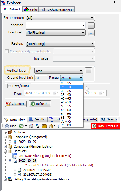
Drone test analysis framework is based on multi layered data drill down. 3D space is sliced into customizable vertical layers by means of applying vertical layer range filter under Data Explorer | Dataset.
Vertical layer filter is applied by selecting previously defined filter configuration and specific altitude range. Vertical layer filter option is turned off by default by having [No Filtering] choice selected.
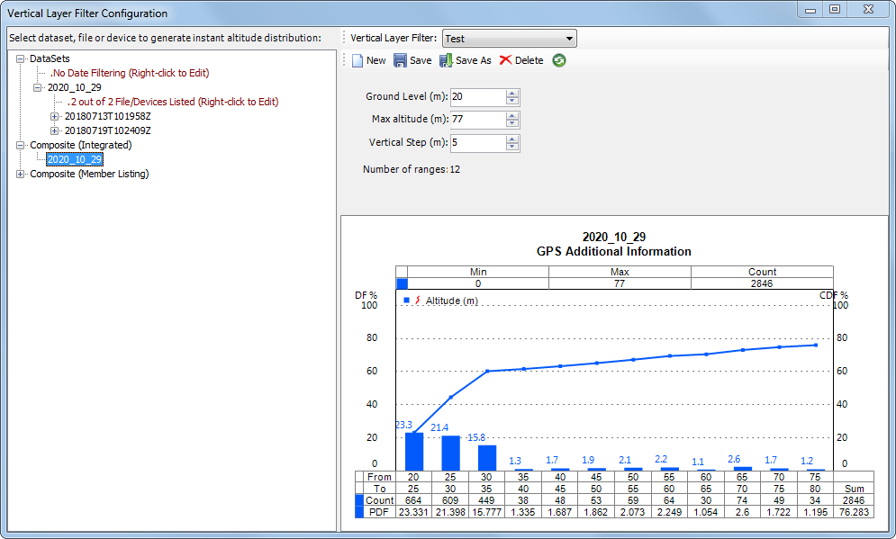
 Vertical layer configuration command button opens a UI window from which user can modify existing or create new vertical layer filter configuration. Selection of an existing filter configuration will populate saved configuration parameter values. Selection of a dataset, individual log file or composite dataset will pre-populate dataset fitting configuration parameters and generate instant histogram chart showing altitude per range distribution. ‘Ground level’ and ‘Max altitude’ values are in such case initially set to minimum and maximum altitude values identified in selected dataset, while ‘Vertical step’ parameter is initially set at the default 5m value. User may further manually adjust filter configuration parameters with the following restrictions - (1) Negative values are not permitted, (2) Max altitude value needs to be greater than Ground level value and (3) Vertical step value needs to be greater than zero. Number of ranges value will change automatically to reflect any of parameter modifications.
  Refresh histogram button needs to be applied after changing filter parameters to generate updated instant histogram chart output.
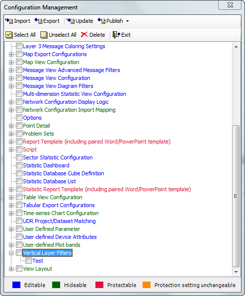
Once filter parameter values are finalized, they need to be saved to a new or existing filter configuration before they can be applied in Data Explorer or Report Builder. Saved Vertical layer filter configurations will be available under Configuration | Configuration Management from where they can be exported for sharing with other users or deleted.
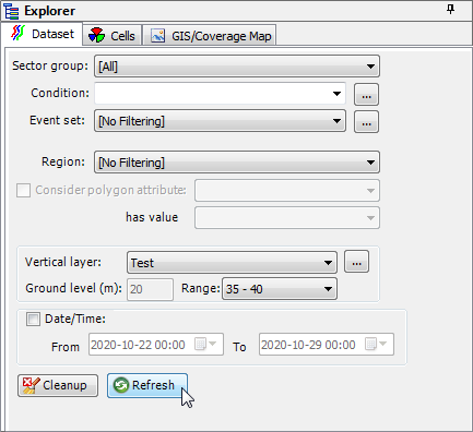
Selection of Vertical layer filter range will not automatically update populated system views. User may apply local Refresh button to update individual system view including sub-views, if applicable, or use global Refresh button located on Data Filter tab to update all populated system views and sub-views.
User may move between vertical layers with a simple mouse click by applying Vertical layer filter change button

from the Map View. Left mouse click on the button will change filter range to the next layer up (e.g. from 0-5 to 5-10) and will have no effect if highest range is already selected. Right mouse click on the button will change filter range to the next layer down (e.g. from 5-10 to 0-5) and will have no effect if lowest range is already selected. Left or right mouse click on the button will automatically refresh all populate map sub-views.
Vertical layer filter configurations are integrated into
Options of Repetition in Report for automated per layer reporting.