74. Map Windows
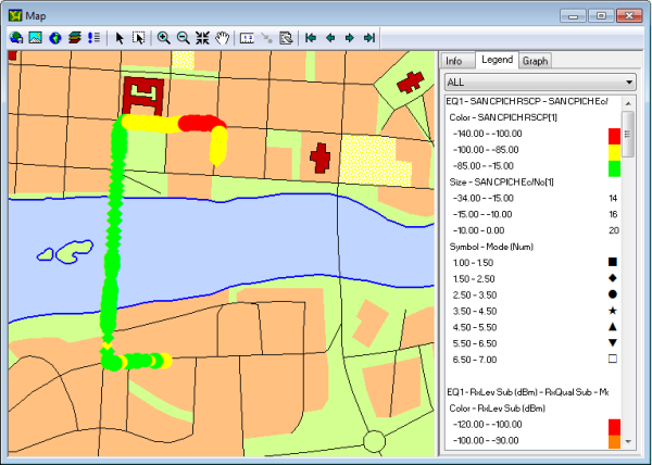
Map windows are used to display a map of your testing area and present your drive test route graphically on this map. Data on cells, events, and information elements are shown along the route in symbolic form; numeric values can also be easily accessed. Like the other presentation windows, Map windows are fully user-configurable.
This chapter deals with the presentation of data in Map windows. The preliminaries of loading map images into a Map window are gone through in chapter "Loading Maps".
Note that to be able to plot measurements on a map, TEMS Investigation must have access to positioning data.
A map of the world is provided with the installation. In the example below, a different map has been loaded.